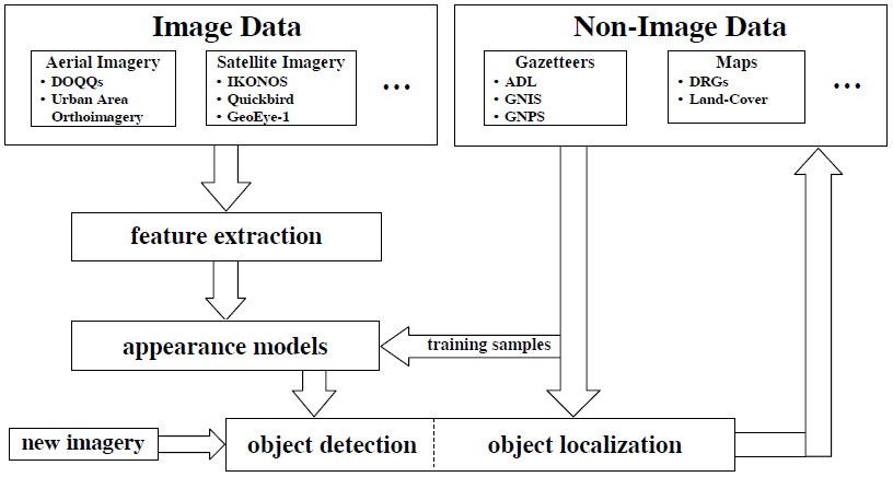
A characteristic of remote sensed imagery which has not been sufficiently exploited by the analysis community is that the images can be georeferenced to extensive repositories of non-image geospatial data such as maps and geographic dictionaries termed gazetteers. In particular, these associations represent a rich source of labeled data needed to train the analysis algorithms.
This project develops a framework for learning appearance models for a large set of geospatial objects indexed by an extensive gazetteer in an unsupervised fashion. Besides the standard challenges such as choice of features and form of the model, this problem is made interesting by the fact that current gazetteers only specify the spatial footprint of indexed objects using a single point location. Methods are explored for simultaneously estimating the model parameters and the spatial extents of the known objects.